file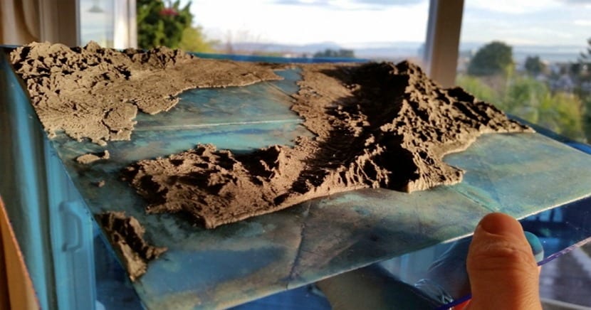
The world of 3D printing still has a lot to offer us and many surprises to discover. A few hours ago I was surprised by a new product that I did not expect to come from 3D printing.
A company called R&D Technologies has fixed the problem of STL files so now you can print maps and topographic models with your printers.
Of course, many of you will say that also by printing cad files you can get the same. You are absolutely right but CAD files have to be created, either through external objects or by hand. But stl files only need Google Earth and a program that captures that information, so printing topographic models with two clicks is very easy.
Terrain2STL helps us create STL files just by selecting the area
For those who do not want to depend on a program that generates the stl files, Ritcher, one of the R&D Technologies workers, has created the Terrain2STL website which loads the Google Earth map and allows us to select the area that we want to include in the stl file.
If you look at the images you can see the results that these files give, some very large prints that will certainly improve or change everything that is based on or works with topographic models.
Currently reproducing a topographic model of a specific area has a very high cost, something that can be reduced considerably.
The current downside is that few printers can play stl files natively, something that will surely change over time. Now for the moment only printers from R + D Technologies do it. But Will it last long like this? What do you think of these new features for 3D printing?
Image- 3DPrint.com